Rio Rico, Arizona
Rio Rico, Arizona | |
|---|---|
 The eastern half of Rio Rico along the foothills of the San Cayetano Mountains | |
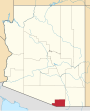
 Location of Rio Rico in Santa Cruz County, Arizona | |
| Coordinates: 31°28′17″N 110°58′35″W / 31.47139°N 110.97639°W[1] | |
| Country | |
| State | |
| County | Santa Cruz |
| Area | |
| • Total | 63.27 sq mi (163.88 km2) |
| • Land | 63.09 sq mi (163.39 km2) |
| • Water | 0.19 sq mi (0.49 km2) |
| Elevation | 3,481 ft (1,061 m) |
| Population (2020) | |
| • Total | 20,549 |
| • Density | 325.73/sq mi (125.77/km2) |
| Time zone | UTC-7 (MST (no DST)) |
| ZIP code | 85648[3] |
| Area code | 520 |
| FIPS code | 04-60180 |
Rio Rico is an unincorporated community and census-designated place (CDP) in Santa Cruz County, Arizona, United States.[1] The population was 18,962 at the 2010 census. The Rio Rico CDP replaced the former CDPs of Rio Rico Northwest,[4] Rio Rico Northeast,[5] Rio Rico Southwest,[6] and Rio Rico Southeast.[7]
Geography
[edit]Rio Rico is located in Santa Cruz County, north of Nogales at the confluence of Sonoita Creek and the Santa Cruz River.[8]
According to the United States Census Bureau, the community has a total area of 62.3 square miles (161.2 km2), all land.[9]
Rio Rico includes the site of the ghost town of Calabasas, Arizona.
Demographics
[edit]| Census | Pop. | Note | %± |
|---|---|---|---|
| 2010 | 18,962 | — | |
| 2020 | 20,549 | 8.4% | |
| U.S. Decennial Census[10] | |||
As of the census[11] of 2010, there were 18,962 people living in the community, making it Santa Cruz County's second-largest community after its historic population center and county seat, Nogales. The population density was 304.6 inhabitants per square mile (117.6/km2). There were 6,356 housing units at an average density of 102.1 per square mile (39.4/km2). The racial makeup of the community was 85.3% Hispanic or Latino, 0.4% Black or African American, 0.6% Native American, 0.5% Asian, 0.1% Pacific Islander, and 1.8% from two or more races. Approximately 11.4% of the population is non-Hispanic white.
See also
[edit]References
[edit]- ^ a b c U.S. Geological Survey Geographic Names Information System: Rio Rico Census Designated Place
- ^ "2020 U.S. Gazetteer Files". United States Census Bureau. Retrieved October 29, 2021.
- ^ "Rio Rico ZIP Code". zipdatamaps.com. 2023. Retrieved January 12, 2023.
- ^ U.S. Geological Survey Geographic Names Information System: Rio Rico Northwest Census Designated Place (historical)
- ^ U.S. Geological Survey Geographic Names Information System: Rio Rico Northeast Census Designated Place (historical)
- ^ U.S. Geological Survey Geographic Names Information System: Rio Rico Northwest Census Designated Place (historical)
- ^ U.S. Geological Survey Geographic Names Information System: Rio Rico Southeast Census Designated Place (historical)
- ^ Rio Rico, Arizona, 7.5 Minute Topographic Quadrangle, USGS, 1981 (1992 rev.)
- ^ "US Gazetteer files: 2010, 2000, and 1990". United States Census Bureau. February 12, 2011. Retrieved April 23, 2011.
- ^ "Census of Population and Housing". Census.gov. Retrieved June 4, 2016.
- ^ "U.S. Census website". United States Census Bureau. Retrieved August 3, 2017.
External links
[edit]![]() Media related to Rio Rico, Arizona at Wikimedia Commons
Media related to Rio Rico, Arizona at Wikimedia Commons


